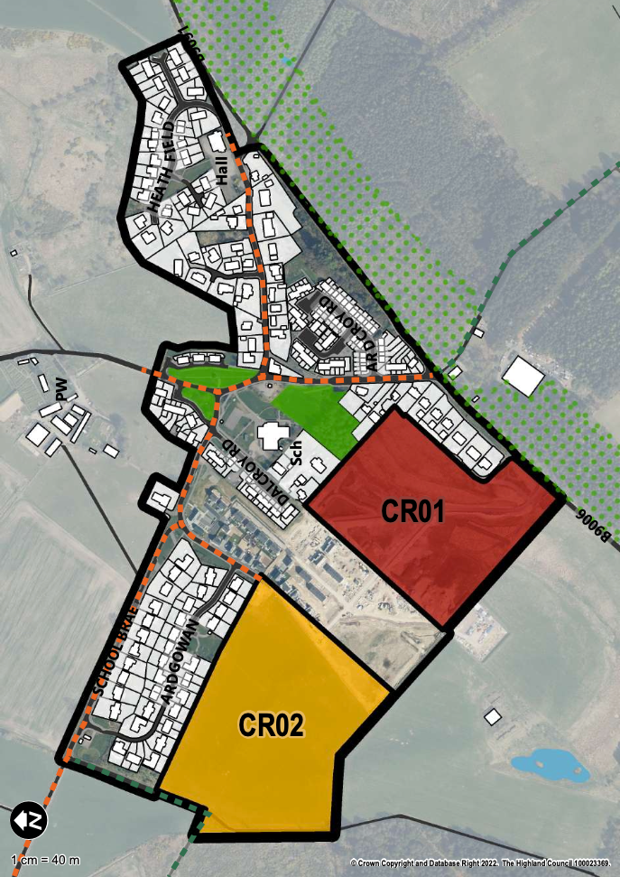
Figure 1: Map 12 Croy, Inner Moray Firth Local Development Plan 2, page 129, published for consultation 25th March 2023.
The land allocation CR01: West of Primary School is allocated for housing, over an area circa 5.1ha and with an indicative housing capacity of 50 units. Full planning permission has previously been granted, 17/02509/FUL. Reference CR01: West of Primary School, Inner Moray Firth Local Development Plan 2, published for consultation 25th March 2023.
This area of land is generally under construction, sited below the new Milne Avenue access and speed limits on the B9006.
What impacts has the development of CR01 had for you and for Croy? What more needs to be done to ensure that Croy continues to develop and grow in a sustainable, green, and resilient way? Has CR01 added to, or reduced, the quality of your green network and active travel path network to Nairn and Nairnshire, or into Inverness or the Dalcross commercial and industrial areas?
We would love to know what you think, either directly at lpp@nicenairn.org.uk, or leaving your comment below.